
As the name of this post indicated, this past weekend I was supposed to hiked 11 miles through the Ohiopyle State Park.
I guess technically you could say it was only 7 miles (4 miles were out of the park) but things went a tad bit astray…

The trail head that we started was the Laurel Highlands Hiking Trail (really popular in the southwestern region of Pennsylvania). Our starting point was the Ohiopyle Bakery and Sandwich Shoppe (yum!); ending point was (suppose to be) Maple Summit Road. If you look closely enough you’ll be able to see the trail on this map from the PA DNCR.
All together there were 8 of us that started the trek and really only 2 finished the main plan. I was in the group of six that ended up taking a detour(?). But I’ll get to that later…
We began the trek around 10 AM on a gorgeous summer day with clear blue sky and a blazing hot sun. 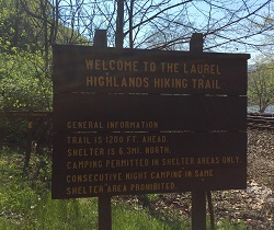 The first several miles started off hiking up the side of one of the mountain following along the river. As we got to mile two the trek started to greatly incline. We started to leave the river behind and were only able to catch glimpses of it in the distance through the sprouting trees and leaves.
Eventually we reached a casual stopping point at a rock that juts off the edge of the mountain and opens it up this an incredible view of the valley and river-bend below. Check this view out:

Around 3.5 miles we stopped for a mini break to catch our breath, 
get some food, and enjoy the coolness of the creek.
It was great to get outside! It was so nice to be hiking in the quiet forest with the only sound being the birds chirping and our group whistling back at them. I live for days like that.

Around 5.5 miles my little crew decided to stop near a small creek of running water to take a longer break and rest for lunch. While stopping on our break a few of us had that “Oh s**t” moment as each of us was already half way through our second bottle of water. We’re just now half way through the hike! — There is no way – we’ve been hiking for what feels like almost 8 miles! — Okay, let’s try to calculate…
We luckily had the GPS turned on in our phones and according to them we were around 7.69 miles… still though, according to the mile markers we would just be coming up on mile 6 in a bit. Panic starts to set it. Either one of two things can happen now: (1) we are almost done and can finish this hike with the little water we have left or (2) we are only half way and going to run out of water.
 At this point in time we had no idea. So we continued on a bit further until we found someone with a map.
Come to find out our GPS’ were tracking our trek longer than the actual trail markers. So at about 6.25 miles we got to a break point where we could stray off our intended path and walk down an off-scale road for 2.5 miles onto a different portion of Maple Summit Road.
Okay, that seemed doable, but first WATER!

On the map there is clearly an indication that water is obtainable at the shelter point, just another .25 miles on the main trail. So a group of us gather our water bottles and make the short trip only to arrive at the shelter and water location to find this sign:
“Water is not potable. Not for human consumption.”
Finally, we made it!! Such relief hitting the main road, hearing the cars and the radio. At this point I’m completely out of water but still manage to have a smile on my face from knowing that I’ll be getting some soon. Also, because at this point I feel extremely accomplished for completing the hike. I pull out my phone and the total distance on my GPS reads 12.02 miles. That I believe.


